
Ceres ZIP Codes and Coverage
The primary Ceres postal geography is 95307, but 95351 reaches the northern Ceres vicinity and southwest Modesto. ZIP lines are delivery boundaries, not city limits. The table keeps the two known relationships clear and points to the source that can settle an individual address.
| ZIP | Areas covered | Post office | Notes |
|---|---|---|---|
| 95307 | Incorporated Ceres and some Ceres-mailing territory | Ceres Post Office, 2801 Mitchell Road | Primary Ceres ZIP; line is not the city boundary |
| 95351 | Southwest Modesto and the northern Ceres vicinity | Modesto postal facilities | Verify every address; it crosses the Ceres and Modesto seam |
No verified Ceres-only unique or PO-box-only ZIP was located in the research. A postal directory should therefore state what is known, point to USPS for the address-level answer, and avoid turning a postal label into a claim about jurisdiction.
Finding Ceres Residents by ZIP Code
A ZIP-filtered resident search has to be assembled from sources because no verified local portal produces a ZIP-wide household list. Use the ZIP to narrow the geography, then switch to a parcel, street, name, or historical record. The step order below keeps the postal clue from being mistaken for a city or residence fact.
- Write the full street address, city label, state, and ZIP exactly as supplied.
- Confirm the address and current ZIP through the USPS ZIP lookup.
- Check the Ceres Street Address Locator and county GIS for city limits, APN, and neighboring parcels.
- Use the assessor by APN, RecorderWorks by name or document, or the appropriate court or directory source.
- Once one ZIP narrows to a street, switch to the Ceres street directory address chain.
A postal directory can help sort a family list, historical address set, or property question. It cannot supply a public name browse when the underlying portal does not accept ZIP or when the source is purpose restricted.
Ceres 95307 Postal Geography
95307 is the dominant Ceres ZIP and is served by the Ceres Post Office at 2801 Mitchell Road. USPS reported that the lobby reopened June 9, 2026 after a roof-leak closure. That update is a useful reminder to check current office status before relying on a counter or mailing route for a ZIP-related request.
Postal service territory can include Ceres-mailing addresses beyond a simple incorporated polygon. A city street locator, county GIS city-limit layer, APN, and planning record provide stronger jurisdiction evidence than 95307 alone. The postal city is a delivery label. The legal city is a dated government boundary.
Use the USPS Ceres office update as the source for the reopening note. It supports delivery and office context, not a claim that every 95307 address lies inside city limits.
Ceres 95351 Edge Addresses
95351 is primarily associated with southwest Modesto, yet the research found Ceres-area examples using that ZIP. A Ceres planning agenda identifies 1351 E. Hatch Road, APN 039-032-042-000, within Ceres jurisdiction while using Ceres, CA 95351. Ceres Fire Station 16 at 830 Pecos Avenue is another Ceres facility with a Modesto, CA 95351 postal locality.
These examples show a ZIP code directory boundary oddity. They do not mean that every 95351 address is in Ceres, nor that every Ceres address uses 95351. The full address, APN, city-limit locator, and dated planning or annexation record must be read together.
USPS material identifies the Paradise station at 1717 Paradise Road as serving 95351 and 95358. A delivery route can therefore be useful for mail, while the county and city sources remain the better route for a parcel or jurisdiction question.
Ceres ZIP Codes vs City Limits
The Ceres Street Address Locator is the local answer to the ZIP-versus-city problem. It publishes numbered-street ranges and named-street PDFs, and the city warns that additions or corrections can occur. The table includes ranges such as 2nd Street 2004 to 2800, 3rd Street 2004 to 2944, 4th Street 2004 to 3210, 5th Street 1900 to 3052, 6th Street 2001 to 3608, 7th Street 1201 to 3238, 8th Street 3004 to 3237, and 9th Street 2504 to 3699.
Those ranges are a boundary reference, not a title record. A number outside a published range may use Ceres as a mailing city while lying in unincorporated county territory. A number inside a range should still be checked against the dated GIS and APN because annexations can change the government channel over time.
For a direct check, use the Ceres Street Address Locator, then save the date viewed. That record date matters when a later ZIP code directory search is compared with an older permit, deed, or notice.
Confirm Ceres ZIP by USPS
The USPS tool is the correct first stop for an individual delivery address. It can verify the city, state, and ZIP associated with a complete address, while local sources answer a different question about incorporation or a parcel. Do not assign a ZIP from a city map or from a nearby address.
The capture below links to the official USPS ZIP Code lookup. It belongs in the Ceres ZIP code directory because postal boundaries can change or can be hard to enumerate as a stable polygon.
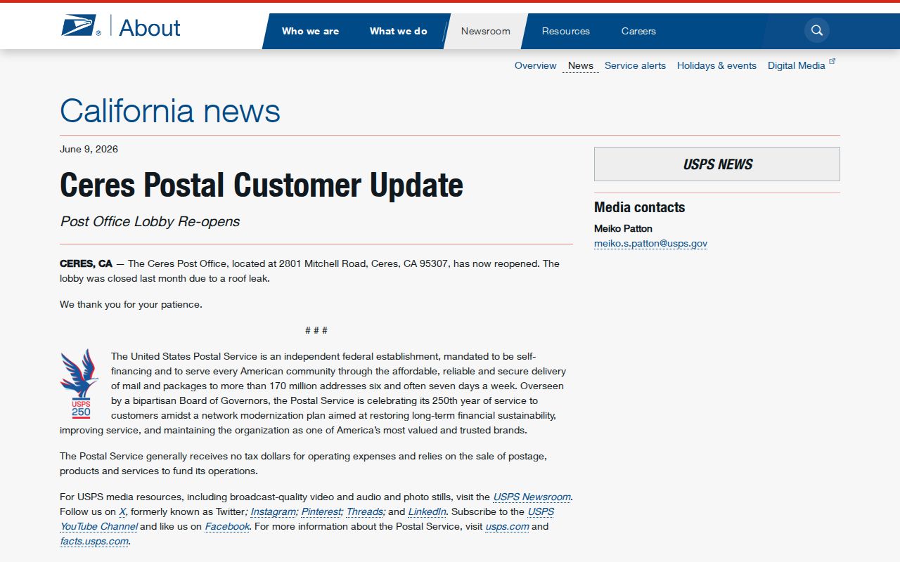
After the USPS result, compare the address with the city locator and APN. If the question is a mailing request, use the postal answer. If it is an ownership, permit, annexation, or court question, use the record custodian and the jurisdiction that applied on the relevant date.
Ceres Situs and Mailing Systems
Three address systems can appear in a Ceres record trail. The situs identifies where a taxable parcel sits. The tax-bill mailing address routes notices to an owner or representative. The postal address follows USPS delivery. A legal description identifies land through a subdivision, lot, block, or metes-and-bounds reference. These systems can agree, but they should be copied as separate fields.
- ZIP code
- A USPS delivery area code. It is not a legal city boundary.
- ZIP+4
- An extended delivery code that can narrow a route or group of addresses; it does not create a parcel boundary.
- PO-box ZIP
- A postal code associated with a box route. No Ceres-only PO-box ZIP was verified in the research.
- Carrier route
- A delivery route used by USPS. It is a mail-service concept, not a residents roll.
- Legal description
- The land reference used in a deed or map. It can remain stable while a postal label changes.
When a name or address appears in several records, label each address type. That simple distinction prevents a tax mailing address, a business address, and a present home from being treated as one fact.
Ceres Annexation Without ZIP Change
Annexation can change which office holds planning or permit material without changing a ZIP code. General Plan 2035 describes a Ceres planning area with 5,989 acres incorporated, 2,456 acres unincorporated inside the sphere of influence, 5,886 acres unincorporated outside it, and 25 acres in Modesto, for 14,357 acres total. A sphere is a potential service area, not present city jurisdiction.
Copper Trails is a current example. The project involves about 535 acres adjacent to Ceres plus additional unincorporated acreage planned for annexation. Annexation files can include owner names and mailing addresses, assessed values, use codes, service providers, boundary maps, and legal descriptions. Notices to owners within 300 feet describe a proposed notice universe, not everyone who lives in that area.
LAFCO controls the boundary process. A ZIP code directory should attach a record date to any annexation statement and use the official Copper Trails project information or the county GIS annexation layer for current status.
Ceres Portals and ZIP Filters
No official local portal identified in the research performs a ZIP-wide resident search. That limitation is the main practical fact behind the Ceres ZIP code directory. RecorderWorks searches by party, document number, or book and page, not ZIP. The free assessor inquiry is APN driven. The Tax Collector accepts an assessment number, fee parcel, or street address, but no verified ZIP field was found. Accela accepts address or street ranges, not a displayed ZIP filter.
| Portal | Useful field | ZIP capability |
|---|---|---|
| Assessor Public Inquiry | APN in 000-000-000 form | No ZIP search in the free web route |
| Tax Collector | Assessment number, fee parcel, street address | No verified ZIP field |
| Accela lookup | Street number range, street name, parcel, owner, record | No displayed ZIP filter |
| RecorderWorks | Party, document number, book and page | No address or ZIP filter |
| My Voter Status | Private voter identifying data | Self-check, not a ZIP-wide browse |
Use ZIP to narrow an address set, then pass the result to the right source. When the ZIP question becomes a street question, the parcel and address route is more precise. When it becomes a person question, preserve the name and date and use a lawful, custodian-based lookup.
The same rule applies to a family list or old address list. Keep the ZIP exactly as printed, note whether it came from a postal label or an official lookup, and record the date of verification. A later USPS change, an annexation, or a corrected city range can alter the best route without changing the underlying family clue. The ZIP code directory is most useful when it narrows the next question and names the office that can answer it.